Quick Terrain Modeler is the world’s premier 3D point cloud and terrain visualization software package. Designed for use with LiDAR, but flexible enough to accommodate other 3D data sources, Quick Terrain Modeler provides an easy to use software experienc
Quick Terrain Modeler is the world's premier 3D point cloud and terrain visualization software package. Designed for use with LiDAR, but flexible enough to accommodate other 3D data sources, Quick Terrain Modeler provides an easy to use software experience that allows users to work with significantly more data, render larger models, analyze data faster, and export a variety of products. These benefits enable very powerful, yet simple and intuitive, terrain exploitation.
Star Vision Limited (SVL) has been conducting various projects that involves 3D data sources. Most projects that use 3D data require a software that is able to work with significantly more data, render larger models, analyze data faster, and export a variety of products. SVL houses software that is exclusive to 3D data sources, one such software is Quick Terrain (QT) Modeler.
Features of Quick Terrain (QT) Modeler
Visualization
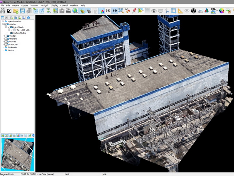
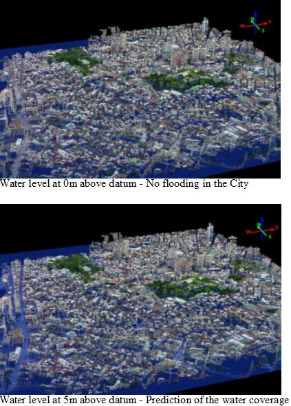
Quick Terrain Modeler allows you to visualize vast amounts of data using the best data representations for your analysis and exploitation. Quick Terrain Modeler can visualize the points as collected in a Point Cloud, as a gridded surface in a DEM, or display both simultaneously. Once you have the data displayed, the user can enhance the view using visualization tools such as custom lighting, custom elevation palettes, model coloration, and elevation exaggeration.
Produce
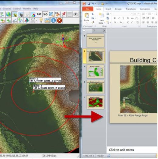
LiDAR point clouds and DEM’s are wonderful achievements by themselves, but ultimately the data was collected to assist in planning and decision making. For those users whose responsibility is to exploit LiDAR, you know that showing someone a point cloud or DEM is not enough. What is required is a standard product in a format that the end user can understand and use. Most typically, this means highly annotated PowerPoint presentations, Grid Referenced Graphics (GRG’s), routes exported to Garmin GPS, AVI movies, and other standard products. Quick Terrain Modeler takes the time and the trouble out of creating these standard products with tools like direct export to pre-made PowerPoint templates, useful 3D annotation tools, markers that can display images and/or symbology, direct export to GPX/Garmin GPS devices, and AVI video fly-through tools.
Build and Edit
Quick Terrain Modeler can work with both pre-built models (DEM’s, DTED’s, etc.) or with raw point data. When starting with raw point data, typically in LAS format, users can either build point clouds or surface models (or both) from these files. When creating surface models, QT Modeler offers a wide variety of gridding and triangulation options.
Quality Analysis
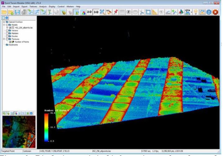
With QT Modeler the user can change the height coloration, display by attributes (intensity, classification, number of returns, etc.) and have the results displayed instantaneously.
GIS Features
With QT Modeler the user can drape an imagery over point clouds and surface models. QT Modeler can import and export shapefiles and is tightly integrated with Google Earth.
Analytical Capabilities
QT Modeler is equipped with line of sight capabilities, have robust point querying and filtering capabilities, and makes select tools available for batch scripting.
Download a free trial license of Quick Terrain Modeler:
USA Versions: QT Modeler USA (64-bit)
International Versions: QT Modeler International (64-bit)